What is KūtaiCam?
The KūtaiCam coastal monitoring platform is the first deployed to provide information for the development and improvement of open ocean structures. It is funded by the Cawthron institute in support of a MBIE funded program, ‘Enabling Open Ocean Aquaculture’. It has a sister buoy based in Pegasus Bay which is monitoring the same parameters.
What does it do?
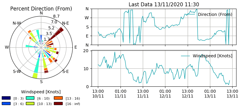
KūtaiCam records long-term information on simple but significant parameters like water temperature, air temperature, wind velocity and direction, wave height and direction and water currents. The water currents are measure continuously at 1 meter steps down to 40m deep.
Who uses the data?
The data is used to provide information about conditions on site so that equipment can be designed or adapted to those conditions. This data tells us what conditions the aquaculture species (like mussels, oysters or seaweed) are living in. Whakatohea Mussels vessels will also use the buoy to get onsite conditions before they leave the harbour. KūtaiCam also provides information for local marine users such as recreational fisherman, the Coastguard and the Regional and District Councils and a continuous data set which can be used in the future to define changes in the oceanographic conditions of the region.
How often is data updated?
Data is downloaded every 45 minutes. Plots are generated automatically and uploaded to the site.


Above – Graphs are updated as new data is downloaded every 45 minutes.
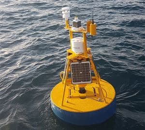
Left – The KūtaiCam monitoring buoy in Opotiki harbour.
Paul Barter
Scientist – Environmental Impact Assessments & Aquatic Technologies
